 Click on map to view
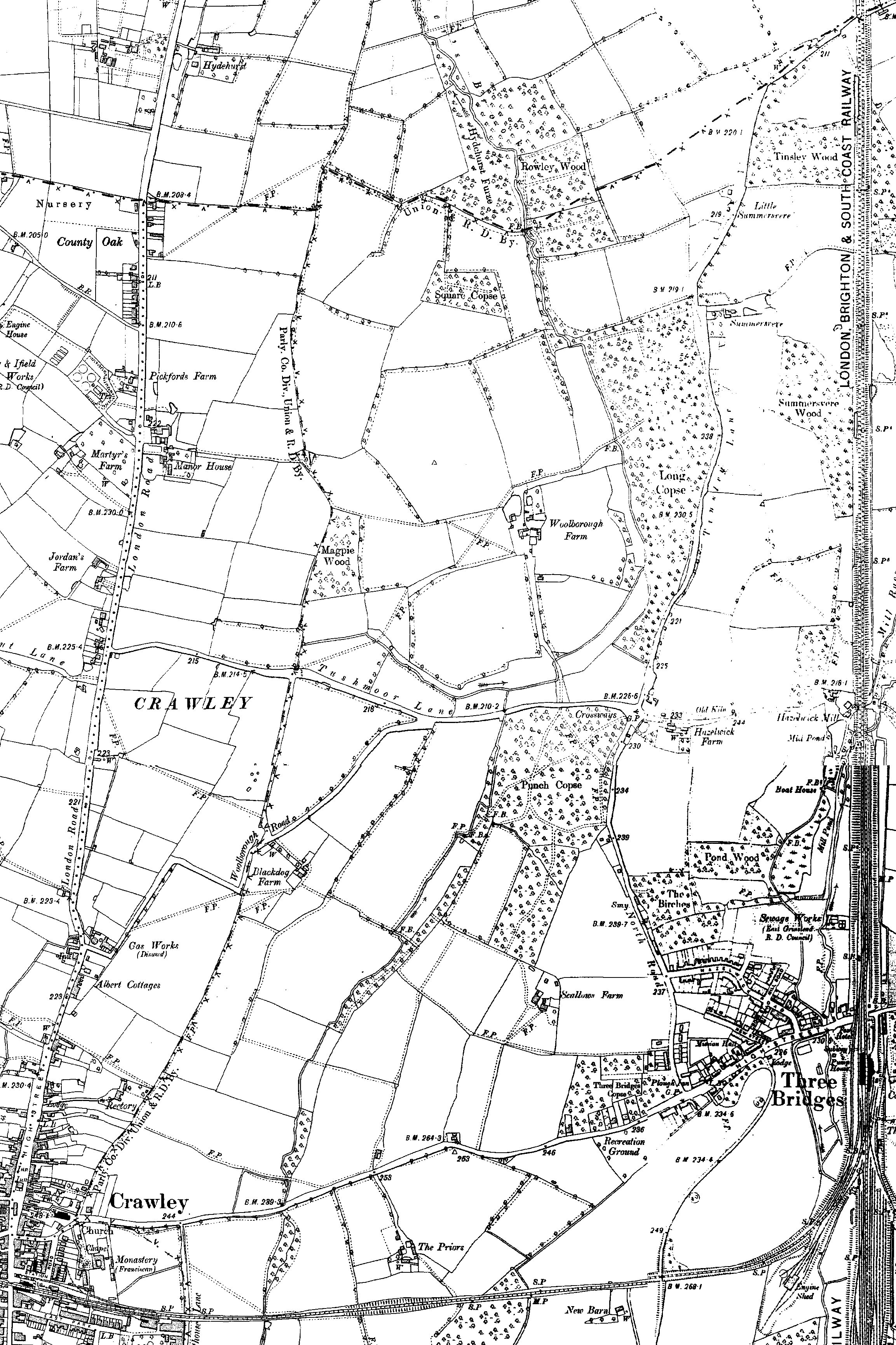
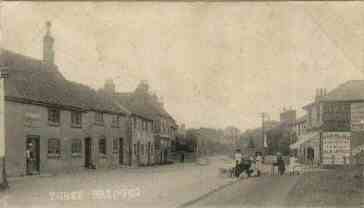
The "new makyng of thre bridges upon the wayes between the hamer at Worth and Crawley" is mentioned in the Worth furnace accounts of 1546-49. Three narrow bridges, a few yards apart, over separate streams are shown on the 1842 tithe map, but since the railway came one larger bridge has replaced them.
The New Town residential areas of Three Bridges and Northgate - named after a tollgate on the London Road - were developed between 1952 and 1955. Northgate covered an area of 168 acres.
| Year | Population | |
|---|---|---|
| Three Bridges | Northgate | |
| 1981 | 5,400 | |
| 2001 | 5,648 | 4,407 |
| 2011 | 7,253 | 5,298 |
Northgate
Clappers
A pond near the junction of London Road and Black Dog Lane which would overflow the highway. The name derives from a Clapper bridge built across it, consisting of planks raised on logs or stones.
Sources & Further Reading
Wayfarer Denman's Crawley Revisited, Nadine Hygate (1993), p. 18
Hollybush Road
A late 16th century timber-framed one storey farmhouse. The front was faced in red brick about 1800 and given three wooden casements under segmential arches. The chimney stack is 17th Century. There is a single storey brick and tiled outbuilding.
London Road
A two-storey timber framed house probably late 17th century. The ground floor of the south front is refaced in stucco and the first floor is tile hung. It is shown as 'Crawley Workhouse' on the Tithe Map.
Northgate Avenue
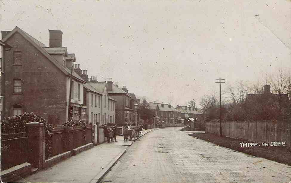
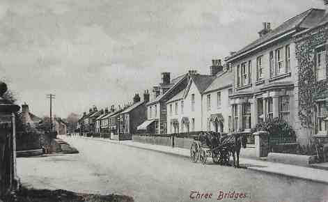
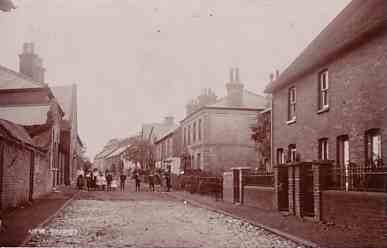
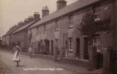
Three Bridges
Crossways
Were the road from Three Bridges to Tinsley Green, and the road from The Sun Inn, Crawley, to Hazelwick Mill crossed. Crossways was just to the south of the current flyover and roundabout at the junction of Hazelwick Avenue, Gatwick Road and Crawley Avenue.
Haslett Avenue
Caroline or Robert Haslett - What's in a street name?, Crawley Observer, 1st August 2018
Hazelwick Avenue
Hazelwick Mill and Pond
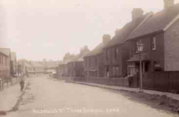
High Street
|
High Street, 281-283 Three Bridges Road
High Street, 279 Three Bridges Road
7 High Street
Jack Barker (TA"Barker") - Turf Commission Agent (1938)
9 High Street
AT Underwood - Estate Agents , Surveyors & Valuers(1938)
The Homefinder (1938)
Guy White & Mason - Solicitor & Commissioner for Oaths (1938)
9a High Street
Benjamin Horation Barker - Confectioner (1938)
11 High Street
George Barker & Son - Motor Car Agents (1938)
13 High Street
Charles Alex Dack - Tobacconist (1938)
15 High Street
Annie Bysshe - Fruiterer & Greengrocer (1938)
21 High Street
Thomas George Kennard - Grocer (1938)
23 High Street
Blue Ribbon Dairy (1938)
25 High Street
Ernest Reginald Banks - Terenzio, Draper & Post Office (1938)
27 High Street
Albert Laker - Butcher (1938)
29 High Street
Laker & Puttick - Butchers (1938)
37 High Street
Sarah M Jones - Midwife (1938)
41 High Street
Stanley N Wilkinson - Furniture Dealer (1938)
47 High Street
Harold George Stidson - Grocer (1938)
59 High Street
John Robinson - Shopkeeper (1938)
61 High Street
Finch & Francis - Hairdressers (1938)
63 High Street, 211 Three Bridges Road
Leonard Geddes - Chemist (1938)
75 High Street, 199 Three Bridges Road
77 High Street, 197 Three Bridges Road
Charles Harvey - Confectioner (1938)
79 High Street, 195 Three Bridges Road
Snelling - Butcher (c. 1866-1930s)
Reginald Lyne - Butcher (1938)
91 High Street, 181 Three Bridges Road
175-179 Three Bridges Road
167-173 Three Bridges Road
Known as Mount Pleasant Cottages
Woodlands Garage
Reeves & Huntley - Coal Merchants & Haulage Contractors (1938)
159-161 Three Bridges Road
|
56 High Street
Kate Evelyn Randall & & Mable May - Grocers (1938)
72 High Street, 176 Three Bridges Road<
Tilgate Park Garage (1938)
Proprieter AE Woolger 74 High Street
Christopher & Ada Simmons - Fruiterers (1938)
78 High Street
Catherine Mary Hollingdale - Boot Maker (1938)
80 High Street
William Drury - Shopkeeper (1938)
86 High Street
George Tullett - Coal Dealer (1938)
150-152 & 154-156 Three Bridges Road
Known as Overton Cottages after the man that built them
|
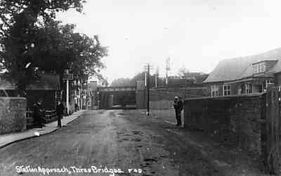 Station Approach
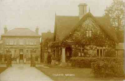 Tilgate Lodge and Hedley House
 View west from Hedley House
 The Plough looking east
New Street
Punch Copse
Punch Copse where the path joins North Road at Crossways
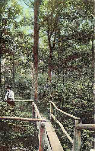
Punch Copse lay to the south of Tushmore Lane (the northern end of which is now part of Woodfield Road) and west of North Road. The crossroad at Tushmore Lane, North Road, Tinsley Lane and Hazelwick Mill Lane was known as Crossways.
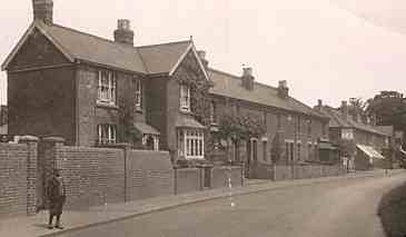
Station Hill
The cottages on Station Hill - leading to the original Three Bridges station entrance - were built in the 1850s. A kitchen range from these cottages are on display at Crawley Museum as part of a Victorian kitchen exhibit.